Geomatics Day - Student project 1
Pointcloud Overlay for indoor Positioning: A Structure from Motion Approach
Navigating large, complex buildings like hospitals or airports can be a frustrating experience for visitors trying to locate the right department or gate. Our project aims to make indoor navigation
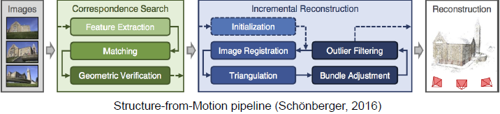
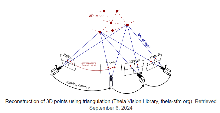
more accessible by using a novel approach that combines photogrammetry and pointcloud matching, putting advanced technology in the palm of your hand. Using the Structure from Motion algorithm, users can capture images of their surroundings with their phone, which are then processed to generate a pointcloud. This pointcloud is matched against an existing ground-truth pointcloud of the building, created through LiDAR scans. Once the user’s position is determined, path-finding algorithms are employed to guide them step-by-step to their destination. This project showcases the integration of cutting-edge techniques in indoor
navigation, with the potential to bring these solutions closer to widespread public use, offering a more efficient and intuitive experience for users navigating unfamiliar indoor spaces.