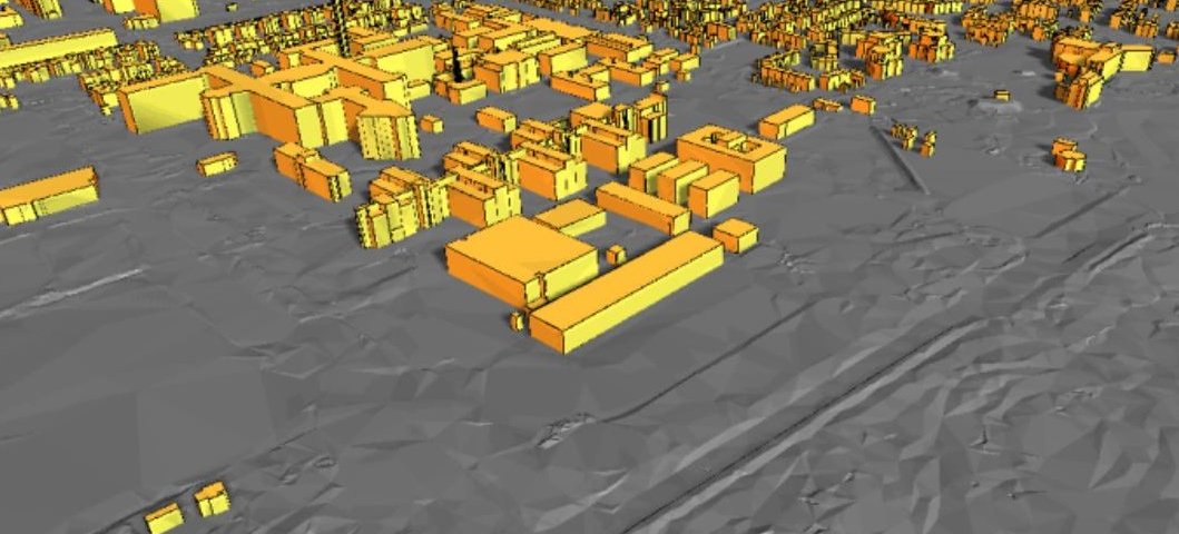
Nationwide 3D Dataset for noise simulations available
For the calculation of noise levels produced by road and rail traffic and industry, a noise expert uses a 3D model of the environment. This 3D model contains information about the height of the terrain, buildings and sound-reflection/absorption properties of the soil. It can be a cumbersome process to create this 3D model. Since last year, noise experts in the Netherlands can use an automatically generated country-wide 3D dataset for noise simulation that was co-developed by the 3D Geoinformation research group, Department Urbanism.
This 3D dataset has recently been renewed. All buildings in the Netherlands that have been built, rebuilt or demolished until January 1st, 2021, have been incorporated in the new dataset and other information has also been updated. In addition, improvements have been made. The dataset is available through the governmental open geodata portal: PDOK (Publieke Dienstverlening Op de Kaart), in a format that allows noise experts to use it directly in noise simulations.
More information
The technique behind the 3D model for simulation has been developed by the 3D Geoinformation research group, Urbanism Department led by Prof. Jantien Stoter in cooperation with RIVM and Kadaster commissioned by the Ministry of Infrastructure and Water Management. This research group also developed the technique behind the 3D BAG dataset (Basisregistratie Adressen en Gebouwen) containing 3D models of all 10 million buildings in the Netherlands.
Read here the previously published news item with an explanation of the research and the application possibilities of 3D BAG. Or go to the project page of 3D geoinformation for detailed information.
Interested in the 3D noise dataset at PDOK? Go to the project page of the Kadaster/PDOK.
